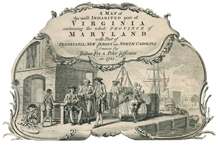
From Williamsburg to Wills’s Creek: The Fry-Jefferson Map of Virginia examines the role of surveyors in colonial Virginia, the importance of the surveying experience for Joshua Fry and Peter Jefferson in creating their important map, and the influence of their map on later cartographic representations of Virginia. The published map included Fry and Jefferson’s completed border survey for the western bounds of the Northern Neck and the dividing line between Virginia and North Carolina. For the first time the entire Virginia river system was properly delineated, and the northeast-southwest orientation of the Appalachian Mountains was displayed.
As Virginians, native-born and immigrant, pushed into the interior and beyond, new opportunities arose for Virginia’s surveyors. These men platted family farms, county boundaries, and towns, and were even called on to determine the colony’s boundaries. As Virginia’s chief cartographers, surveyors filled the constant need for accurate maps. Most of their efforts remained in manuscript form, however, until 1751, when Joshua Fry and Peter Jefferson, among the most knowledgeable surveyors in colonial Virginia, combined their skills and experiences in surveying to produce the definitive map of the colony of Virginia in the eighteenth century.