
Peter Jefferson
After the death of his father, Thomas Jefferson II, of Henrico County, Peter Jefferson settled in Goochland County where he served as a justice of the peace and county sheriff. He probably learned “the elements of surveying” from William Mayo, the surveyor for Goochland County. Jefferson married Jane Randolph in 1739 and moved to Shadwell in Albemarle County. When his friend William Randolph of Tuckahoe, in Henrico County, died, Jefferson moved to Tuckahoe and managed the plantation until Randolph’s son came of age.
Jefferson worked with Fry to survey the Fairfax boundary line and later with Robert Brooke II to produce a map of the boundary based on William Mayo’s 1737 survey. Jefferson and Fry served on the joint commission to survey and to define the North Carolina–Virginia boundary. After Fry’s death in 1754, Jefferson assumed the major public offices held by Fry, including that of the militia lieutenant for Albemarle County and the seat in the House of Burgesses. Peter Jefferson died on 17 August 1757, while under the care of Dr. Thomas Walker, a physician and explorer. Among his children was Thomas Jefferson, the future statesman.
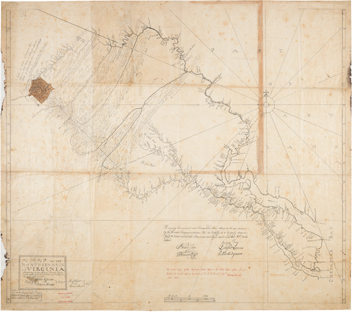 |
Peter Jefferson and Robert Brooke. A Map of the Northern Neck in Virginia. Pen and ink with watercolor on linen. Copied from original manuscript in State Paper Office, London, Book 12, no. 16. Charles Booth. 1860. The Library of Virginia. |
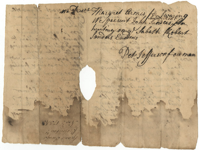 |
Grand Jury Indictments, Albemarle County, Peter Jefferson, foreman. N.d. Manuscript. Goochland County. The Library of Virginia. |
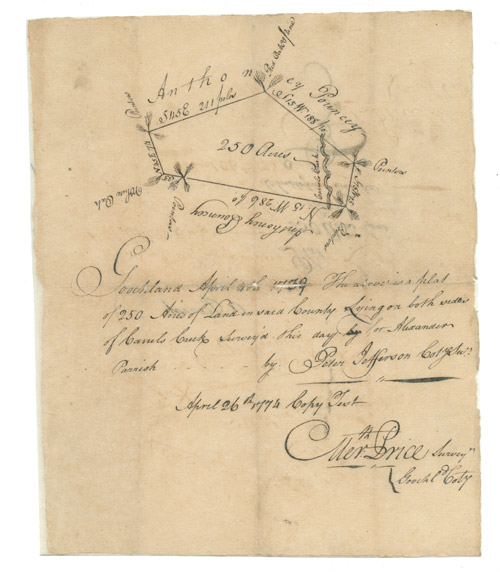 |
Peter Jefferson (1708–1757), Survey of 250 acres for Alexander Parrish. 4 April 1739; copied 26 April 1774. Pen and ink and manuscript. Virginia Land Office, Surveys for 1779. The Library of Virginia. |
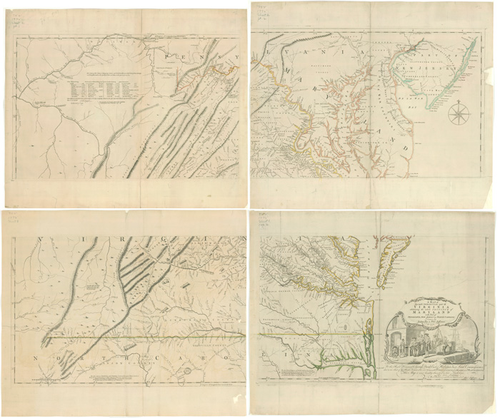
| Joshua Fry (ca. 1700-1754) and Peter Jefferson (1708–1757). A Map of the most Inhabited part of Virginia containing the whole Province of Maryland with Part of Pensilvania, New Jersey and North Carolina. Thomas Jefferys, engraver. London, ca. 1755. State 3. Engraving with outline color. The Library of Virginia. | |
| Joshua Fry (ca. 1700-1754) and Peter Jefferson (1708–1757). A Map of the most Inhabited part of Virginia containing the whole Province of Maryland with Part of Pensilvania, New Jersey and North Carolina. Thomas Jefferys, engraver. London, 1755. State 4. Engraving with outline color and watercolor. The Library of Virginia. | |
 |
Joshua Fry (ca. 1700-1754) and Peter Jefferson (1708–1757). A Map of the most Inhabited part of Virginia containing the whole Province of Maryland with Part of Pensilvania, New Jersey and North Carolina. Thomas Jefferys, engraver. London, 1775. State 6. Engraving with outline color. The Library of Virginia. |