|
d’Engelze Volksplanting in VIRGINIE door Iohan
Smith Bezogt en verder uytgeset. Pieter vander Aa. Leyden. Ca.
1708–1728. Copperplate engraving with hand-color. |
 |
CARTE DE LA VIRGINIE, DE LA BAYE CHESAPEACK . .
. . Jacques Nicholas Bellin (1703–1772). Paris. State 2, 1757.
Copperplate engraving with hand-color. |
 |
VIRGINIA. Published in Jedidiah Morse, The
American Universal Geography. 3rd edition. Boston: Isaiah Thomas
& Ebenezer T. Andrews, 1796. Engraved by Samuel Hill.
Copperplate engraving. |
 |
A New and Accurate MAP of VIRGINIA . . . . .
John Henry (ca. 1704–1773). 1770. London. Copperplate engraving
with hand-color. |
 |
A Map of the country between Albemarle Sounds,
and Lake Erie, comprehending the whole of Virginia. . .
Published in Thomas Jefferson, Notes on the State of Virginia.
London: Printed for John Stockdale, 1787. Copperplate engraving
with hand-color. |
 |
MARYLAND. Fielding Lucas Jr. Baltimore,
1822–1827. Hand-colored engraving. Published as No. 20 in A
Complete Historical, Chronological, and Geographical American
Atlas Philadelphia: H. C. Carey & I. Lea, 1822–1827. |
 |
DISTRICT OF COLUMBIA. Young & Delleker.
1822–1827. Hand-colored engraving. Published as No. 21 in A
Complete Historical, Chronological, and Geographical American
Atlas Philadelphia: H. C. Carey & I. Lea, 1822–1827. |
 |
A NEW MAP OF MARYLAND AND DELAWARE with their
CANALS, ROADS & DISTANCES. S. Augustus Mitchell (1792–1868).
Philadelphia. 1849. Lithographic engraving with hand-color.
|
 |
VIRGINIA, MARYLAND & DELAWARE. Drawn and
engraved by John Bartholomew. Published as No. 10 in Black’s
Atlas of North America. Edinburgh: A. & C. Black, 1856.
Lithograph with color
|
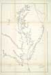 |
U. S. COAST SURVEY A. D. Bache Superintendent
Sketch C SHOWING THE PROGRESS OF THE SURVEY IN SECTION No. III
From 1843 to 1856. A. D. Bache (1806–1867). 1843–1856.
Copperplate engraving. |