

Maps and Formation Information for Isle of Wight through King William Counties
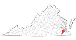 Isle
of Wight County was most likely named for the Isle of Wight off the south
coast of England. It was first known as Warrosquyoake and was one of
the eight shires established in 1634. The present name was given in
1637. Part of Nansemond County was added in 1769. Its area is
319 square miles, and the county seat is Isle of Wight. [Back]
Isle
of Wight County was most likely named for the Isle of Wight off the south
coast of England. It was first known as Warrosquyoake and was one of
the eight shires established in 1634. The present name was given in
1637. Part of Nansemond County was added in 1769. Its area is
319 square miles, and the county seat is Isle of Wight. [Back]
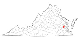 James
City
County was named for James I. It was one of the eight
shires established in 1634. Parts of New Kent and York
Counties were added later. Its area is 144.1 square miles,
and the county seat is Williamsburg. [Back]
James
City
County was named for James I. It was one of the eight
shires established in 1634. Parts of New Kent and York
Counties were added later. Its area is 144.1 square miles,
and the county seat is Williamsburg. [Back]
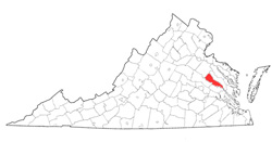
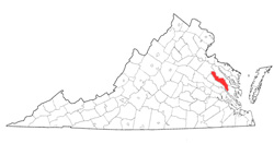 King
and Queen
County was named for William III and Mary II, who were called to
the English throne in 1688. It was formed from New Kent
County in 1691. Its area is 327 square miles, and the
county seat is King and Queen Court House. [Back]
King
and Queen
County was named for William III and Mary II, who were called to
the English throne in 1688. It was formed from New Kent
County in 1691. Its area is 327 square miles, and the
county seat is King and Queen Court House. [Back]
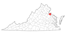 King
George County was named in honor of George I of England and
was formed from Richmond County in 1720. Part of
Westmoreland County was added in 1777. Its area is 181
square miles, and the county seat is King George. [Back]
King
George County was named in honor of George I of England and
was formed from Richmond County in 1720. Part of
Westmoreland County was added in 1777. Its area is 181
square miles, and the county seat is King George. [Back]
 King
William
County was named for William III and was formed from King and
Queen County in 1701. Its area is 285.7 square miles, and
the county seat is King William. [Back]
King
William
County was named for William III and was formed from King and
Queen County in 1701. Its area is 285.7 square miles, and
the county seat is King William. [Back]
