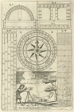
William Leybourn, The Compleat Surveyor. London, 1722.
The Library of Virginia.
Key figures in colonial society, surveyors—especially those appointed as surveyors for a county—created private holdings from public lands. They generally were literate men who learned their craft from books on surveying or through experience. Combining their skills with political connections enabled surveyors to earn appointments as officers of the colony.
Surveying on the frontier entailed considerable risk to the members of the surveying party as they tramped through unexplored swamps and forests and battled snakes, mosquitoes, and disease. Late autumn and early spring were the best times for surveying since there were clear sight lines and generally moderate temperatures. Mapmakers consulted and copied surveys held by landowners, county courthouses, colonial offices, and other surveyors.
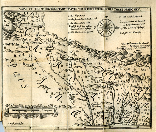 |
John Lederer. A Map of the Whole Territory Traversed by John Lederer in His Three Marches. Published in The Discoveries of John Lederer. London: Printed by J. C. for S. Heyrick, 1672. Bound volume. The Library of Virginia. |
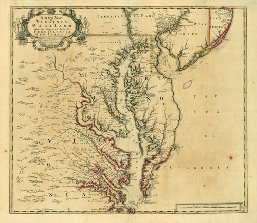 |
John Senex (c. 1678–1740). A New map of Virginia and Maryland and the Improved Parts of Pennsylvania & New Jersey. Published in A New General Atlas. London, 1721. Engraving with outline color. The Library of Virginia. |
 |
Herman Moll (c. 1654–1732). Virginia and Maryland. Published in Atlas Minor. London, 1736. The Library of Virginia. |
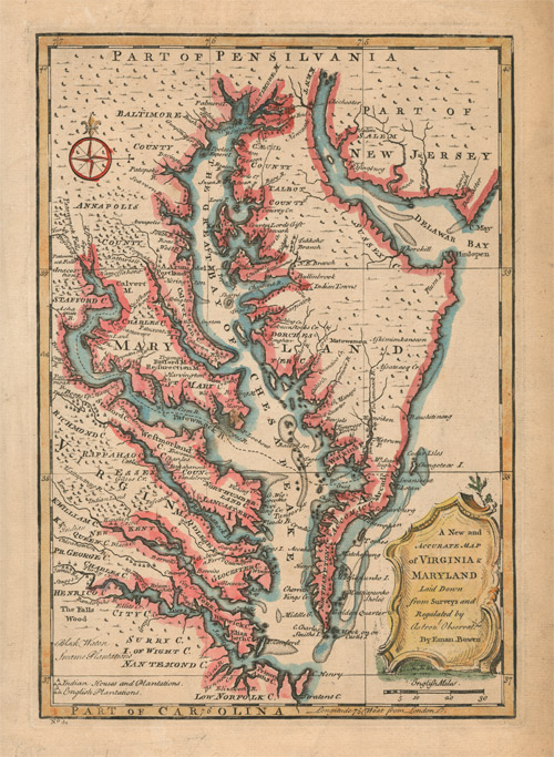 |
Emanuel Bowen (ca. 1693/1694–1767). A New and Accurate Map of Virginia and Maryland Laid Down from surveys and regulated by astronomical observations. London, 1752. State 2. Engraving with hand-coloring. The Library of Virginia. |
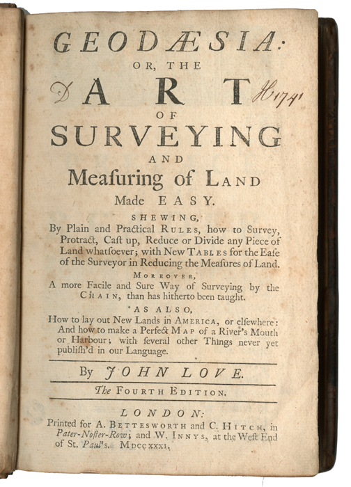 |
John Love. Geodaesia; or, The Art of Surveying and Measuring Land Made Easy. London: Printed for A. Bettesworth and C. Hitch, 1731. Bound volume. The Library of Virginia. |
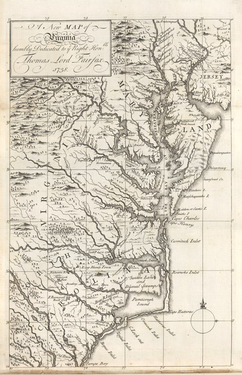 |
Sir William Keith (1680–1749). New Map of Virginia humbly dedicated to ye Right Honble Thomas Lord Fairfax. In The History of the British Plantations in America. London: S. Richardson,1738. Bound volume. The Library of Virginia. |
 |
Virginia. In Flora Virginica, by Johannes Fredericus Gronovius (1611–1671). Lugduni Batavorum, 1762. Bound volume. The Library of Virginia. |
| Plan of the Town of Fredericksbg as first laid off in 50 Acres of Land by Royston and Buckner 1721. After 1728. Pen and Ink. The Library of Virginia. | |
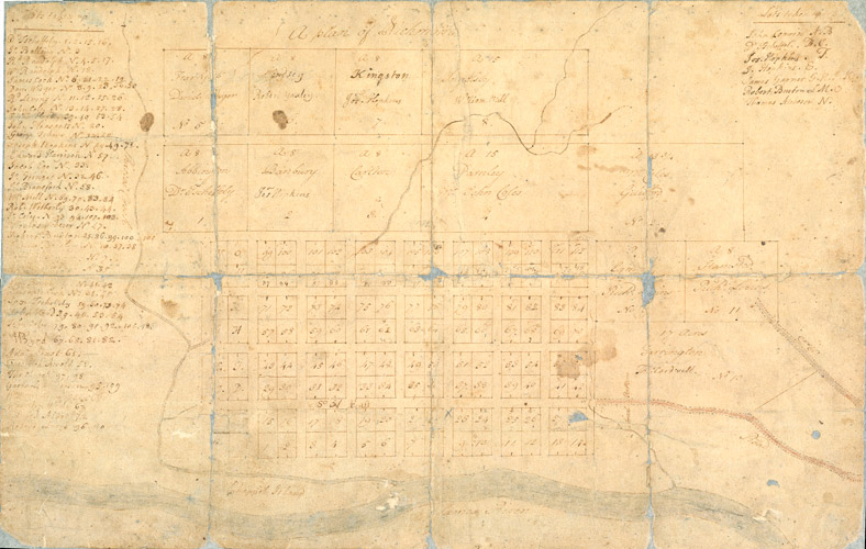 |
William Mayo (ca. 1684-1744) and James Wood (1707–1759). A Plan of Richmond. 1737. Pen and ink and watercolor. The Library of Virginia. |
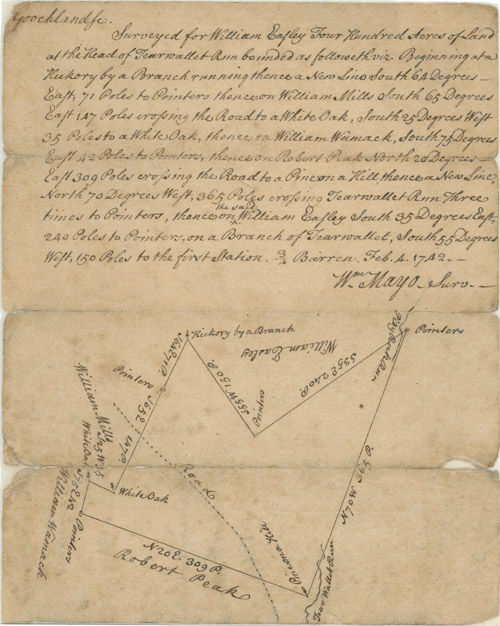 |
William Mayo (ca. 1684–1744). Survey of 400 Acres for William Easley. 4 February 1742. Manuscript. Virginia Land Office, Surveys before 1779. The Library of Virginia. |
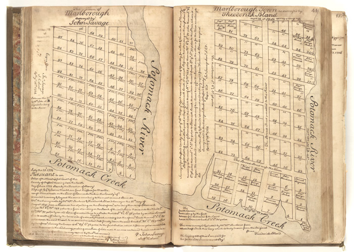 |
[William Buckner]. Marlborough Town as Surveyed by Theodorick Bland and The Town of Marlborough surveyed by John Savage. Copied by John Savage, Surveyor, Stafford County, 26 April 1734. Pen and ink. Tipped in John Mercer, Land Record Book. Bound manuscript. The Library of Virginia. |
 |
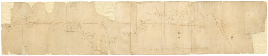
Guy Broadwater. Field notes and surveys. 1749. Manuscript. Virginia Land Office, Northern Neck Surveys. The Library of Virginia. |
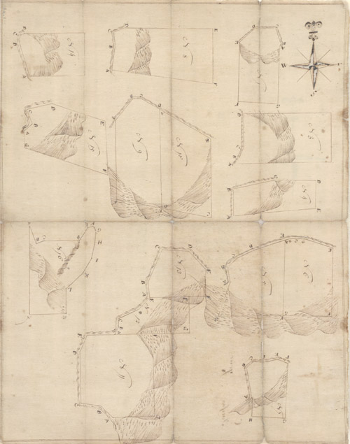
| Sampling of Northern Neck Surveys. 1724–1728. Pen and ink. Virginia Land Office, Northern Neck Survey. The Library of Virginia. | |
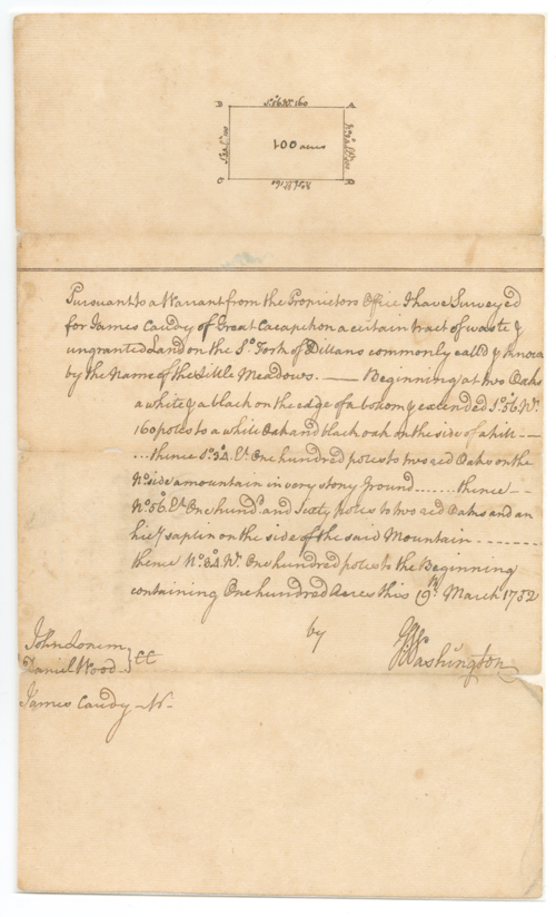 |
George Washington (1732–1799). Survey of 100 acres for James Candy. 19 March 1752. Pen and ink. Virginia Land Office, Northern Neck Surveys. The Library of Virginia. |
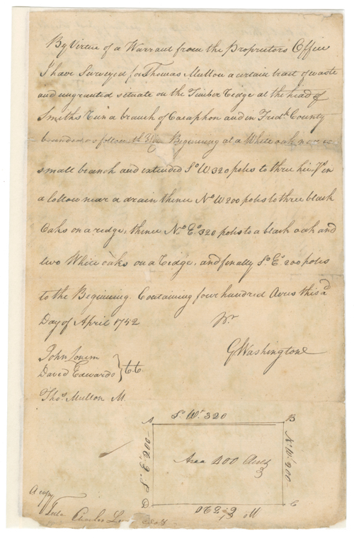 |
George Washington (1732–1799). Survey of 400 acres for Michael Capper, assignee of Thomas Mullon, Frederick County. 2 April 1752. Pen and ink. Virginia Land Office, Northern Neck Surveys. The Library of Virginia. |
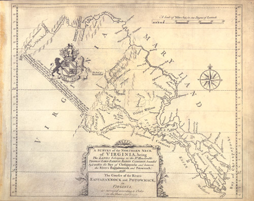 |
John Warner. A Survey of the Northern Neck of Virginia. London, ca. 1747 or later. Fourth edition. Engraved map printed on vellum. In “Scrapbook Relating to Thomas, 6th Lord Fairfax, His Estate and Family,” comp. Orlando Fairfax. Richmond, 18-. Bound volume. The Library of Virginia. |
 |
Thomas Walker (1715–1794) and Daniel Smith (1748–1818). Survey of the Virginia–North Carolina Boundary Line West of the Allegheny Mountains. 1779-1780. Pencil and pen and ink. The Library of Virginia. |