

Maps and Formation Information for Cities of Radford though Winchester
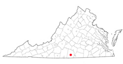
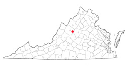
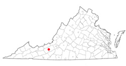 The
City of Radford, in Montgomery County, was at different times known as
Lovely Mount, English Ferry, Ingles's Ferry, Central Depot, and Central
City. The town of Central City was established in 1885 and
incorporated in 1887. Its name was changed to Radford in 1890 to
honor John Blair Radford, a prominent local citizen, and it was incorporated
as a city in 1892. Its area is 10 square miles. [Back]
The
City of Radford, in Montgomery County, was at different times known as
Lovely Mount, English Ferry, Ingles's Ferry, Central Depot, and Central
City. The town of Central City was established in 1885 and
incorporated in 1887. Its name was changed to Radford in 1890 to
honor John Blair Radford, a prominent local citizen, and it was incorporated
as a city in 1892. Its area is 10 square miles. [Back]
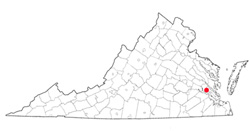
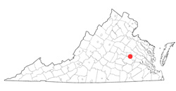 The
City of Richmond is located between Henrico and Chesterfield Counties. It
was named by William Byrd II, who with the help of William Mayo laid out
the town in 1737. The name probably came from the English borough of
Richmond upon Thames. Richmond was established in 1742 and in 1779 was
designated the capitol of Virginia effective April 1780. Incorporated as
a town in 1782 and incorporated as a city in 1842, it was the capital of
the Confederate States of America from 1861 to 1865. Richmond was
enlarged by several annexations, including
Manchester/South Richmond (1910), Barton Heights, Fairmount, and Highland
Park (1914). A further annexation form Chesterfield County occurred in
1970. Richmond's area is 60 square miles. [Back]
The
City of Richmond is located between Henrico and Chesterfield Counties. It
was named by William Byrd II, who with the help of William Mayo laid out
the town in 1737. The name probably came from the English borough of
Richmond upon Thames. Richmond was established in 1742 and in 1779 was
designated the capitol of Virginia effective April 1780. Incorporated as
a town in 1782 and incorporated as a city in 1842, it was the capital of
the Confederate States of America from 1861 to 1865. Richmond was
enlarged by several annexations, including
Manchester/South Richmond (1910), Barton Heights, Fairmount, and Highland
Park (1914). A further annexation form Chesterfield County occurred in
1970. Richmond's area is 60 square miles. [Back]
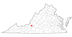
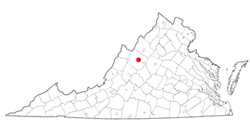
 The
City of Roanoke, in Roanoke County, was first known as Big Lick
because of salt deposits found in the vicinity. The town of
Big Lick was established in 1852 and was incorporated in 1874.
Its name was changed to Roanoke in 1882, and it became a city in
1884. Roanoke was enlarged by annexation from Roanoke
County in 1976. Its area is 43 square miles. [Back]
The
City of Roanoke, in Roanoke County, was first known as Big Lick
because of salt deposits found in the vicinity. The town of
Big Lick was established in 1852 and was incorporated in 1874.
Its name was changed to Roanoke in 1882, and it became a city in
1884. Roanoke was enlarged by annexation from Roanoke
County in 1976. Its area is 43 square miles. [Back]
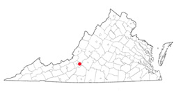
 The
City of Salem, in Roanoke County, was laid out in 1802 on land
owned by James Simpson. The town is said to have been named
by a member of the Bryan family, of Salem, New Jersey. The
General Assembly established Salem in 1806 and incorporated it as
a town in 1836. Salem was incorporated as a city by court
order in 1968. Its area is 15 square miles. [Back]
The
City of Salem, in Roanoke County, was laid out in 1802 on land
owned by James Simpson. The town is said to have been named
by a member of the Bryan family, of Salem, New Jersey. The
General Assembly established Salem in 1806 and incorporated it as
a town in 1836. Salem was incorporated as a city by court
order in 1968. Its area is 15 square miles. [Back]
 South
Boston, in Halifax County, was named for Boston, Massachusetts.
The town originally was located on the south side of the Dan
River and called Boyd's Ferry. It was established in 1796
but was destroyed by floods shortly thereafter.
Reestablished on the north side of the Dan River, it was
incorporated as a town in 1884 and as a city by court order in
1960. In 1995, South Boston reverted to town status within
Halifax County. Its area is 5.09 square miles. [Back]
South
Boston, in Halifax County, was named for Boston, Massachusetts.
The town originally was located on the south side of the Dan
River and called Boyd's Ferry. It was established in 1796
but was destroyed by floods shortly thereafter.
Reestablished on the north side of the Dan River, it was
incorporated as a town in 1884 and as a city by court order in
1960. In 1995, South Boston reverted to town status within
Halifax County. Its area is 5.09 square miles. [Back]
 The
City of Staunton, in Augusta County, was named, according to
tradition, for Rebecca Staunton, wife of Sir William Gooch,
lieutenant governor of Virginia from 1727 to 1749. Staunton
was laid out in 1748 at the site of the Augusta County courthouse
and was established as a town in 1761. It was incorporated
as a town in 1801 and as a city in 1871. Its area is 20
square miles. [Back]
The
City of Staunton, in Augusta County, was named, according to
tradition, for Rebecca Staunton, wife of Sir William Gooch,
lieutenant governor of Virginia from 1727 to 1749. Staunton
was laid out in 1748 at the site of the Augusta County courthouse
and was established as a town in 1761. It was incorporated
as a town in 1801 and as a city in 1871. Its area is 20
square miles. [Back]
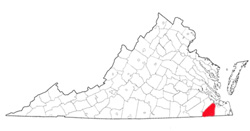 The
City of Suffolk was located in Nansemond County, which is now extinct.
It probably was named for the county of Suffolk in England.
Established in 1742 on the site of John Constant's warehouse, Suffolk was
incorporated as a town in 1808 and as a city by court order in 1910.
In 1974 the city was enlarged when it merged with the former county of
Nansemond. Its area is 400 square miles. [Back]
The
City of Suffolk was located in Nansemond County, which is now extinct.
It probably was named for the county of Suffolk in England.
Established in 1742 on the site of John Constant's warehouse, Suffolk was
incorporated as a town in 1808 and as a city by court order in 1910.
In 1974 the city was enlarged when it merged with the former county of
Nansemond. Its area is 400 square miles. [Back]
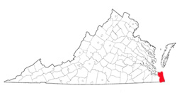 The
City of Virginia Beach was located in Princess Anne County, which is now
extinct. The oceanside resort was incorporated as a town in 1906 and
as a city by an act of the General Assembly in 1952. It was greatly
enlarged in 1963 by consolidation with Princess Anne County, which thereby
became extinct. Its area is 248 square miles. [Back]
The
City of Virginia Beach was located in Princess Anne County, which is now
extinct. The oceanside resort was incorporated as a town in 1906 and
as a city by an act of the General Assembly in 1952. It was greatly
enlarged in 1963 by consolidation with Princess Anne County, which thereby
became extinct. Its area is 248 square miles. [Back]
 The
City of Waynesboro, in Augusta County, was named for Anthony Wayne, an
American general during the Revolution. James Flack and Samuel
Estill laid out the town in 1797. Waynesborough, as it was first
known, was established as a town in 1801 and incorporated as a town in
1834. It was consolidated with Basic City in 1923 and became a city
by an act of the General Assembly in 1948. Its area is 15 square
miles. [Back]
The
City of Waynesboro, in Augusta County, was named for Anthony Wayne, an
American general during the Revolution. James Flack and Samuel
Estill laid out the town in 1797. Waynesborough, as it was first
known, was established as a town in 1801 and incorporated as a town in
1834. It was consolidated with Basic City in 1923 and became a city
by an act of the General Assembly in 1948. Its area is 15 square
miles. [Back]
 The
City of Williamsburg, in James City and York Counties, was established by
the General Assembly as Middle Plantation in 1633. After the capitol
building at Jamestown burned in 1698, the assembly decided to move the
capital of the colony to Middle Plantation, which was renamed Williamsburg
in 1699 in honor of William III. Williamsburg was established in
1699 and declared a "city Incorporate" in 1722, although its actual status
was that of a borough. It served as the capital of Virginia from
1699 until 1780. Williamsburg was incorporated as a city in 1884.
Its area is 9 square miles.
[Back]
The
City of Williamsburg, in James City and York Counties, was established by
the General Assembly as Middle Plantation in 1633. After the capitol
building at Jamestown burned in 1698, the assembly decided to move the
capital of the colony to Middle Plantation, which was renamed Williamsburg
in 1699 in honor of William III. Williamsburg was established in
1699 and declared a "city Incorporate" in 1722, although its actual status
was that of a borough. It served as the capital of Virginia from
1699 until 1780. Williamsburg was incorporated as a city in 1884.
Its area is 9 square miles.
[Back]
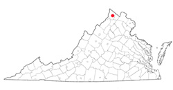 The
City of Winchester, in Frederick County, was first known as Opequon, then
as Frederick's Town (or Fredericktown), and, finally, upon establishment
as a town in 1752, as Winchester. According to tradition, one of the
town's founders, James Wood, named the town in honor of his birthplace in
England. Winchester was incorporated as a town in 1779 and as a city
in 1874. It was enlarged by annexation from Frederick County in
1970. Its area is 9 square miles.
[Back]
The
City of Winchester, in Frederick County, was first known as Opequon, then
as Frederick's Town (or Fredericktown), and, finally, upon establishment
as a town in 1752, as Winchester. According to tradition, one of the
town's founders, James Wood, named the town in honor of his birthplace in
England. Winchester was incorporated as a town in 1779 and as a city
in 1874. It was enlarged by annexation from Frederick County in
1970. Its area is 9 square miles.
[Back]
