
Joshua Fry
A native of Somersetshire, England, Joshua Fry moved to Virginia after 1718. He became a teacher at the grammar school at the College of William and Mary in 1729 and eventually became a professor of natural philosophy and mathematics. In 1737 he married Mary Micou Hill, a widow, with whom he had five children. Fry and his family were living in Goochland County by 1744. When Albemarle County was established out of Goochland, Fry became the new county’s surveyor as well as one of the justices of the county court and a lieutenant of the militia. Fry also represented Albemarle County in the House of Burgesses.
Fry served as the Crown’s agent in 1746 to define the boundaries of the Fairfax grant. In 1749 he joined Peter Jefferson to survey the boundary between Virginia and North Carolina. Like other surveyors, Fry amassed considerable landholdings. In 1752 he was one of three commissioners appointed by Robert Dinwiddie, governor of Virginia, who negotiated the Treaty of Logstown, in which members of the Six Nations agreed to allow the British to build a fort in the Ohio territory. In 1754, as a colonel in the Virginia militia, Fry led troops in the Seven Years’ War. On the way, he suffered severe injuries in a fall and died on 31 May 1754. His sudden death left George Washington in command of the troops.
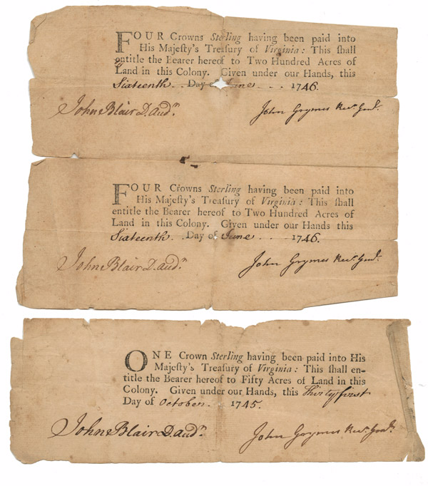 |
Receipt for Joshua Fry. 1746. Printed form and manuscript. Virginia Land Office, Surveys before 1779. The Library of Virginia. |
 |
Joshua Fry (ca. 1700-1754), Survey of 400 acres for William Allen, Albemarle County. 8 April 174-. Pen and ink. Virginia Land Office, Surveys before 1779. The Library of Virginia. |
| Joshua Fry (ca. 1700-1754) and Peter Jefferson (1708–1757). A Map of the most Inhabited part of Virginia containing the whole Province of Maryland with Part of Pensilvania, New Jersey and North Carolina. Thomas Jefferys, engraver. London, ca. 1755. State 3. Engraving with outline color. The Library of Virginia. | |
| Joshua Fry (ca. 1700-1754) and Peter Jefferson (1708–1757). A Map of the most Inhabited part of Virginia containing the whole Province of Maryland with Part of Pensilvania, New Jersey and North Carolina. Thomas Jefferys, engraver. London, 1755. State 4. Engraving with outline color and watercolor. The Library of Virginia. | |
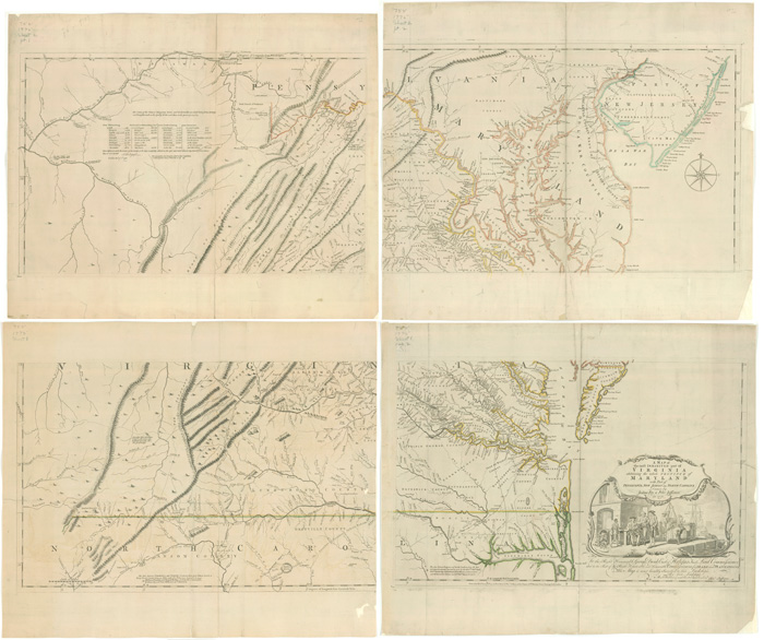 |
Joshua Fry (ca. 1700-1754) and Peter Jefferson (1708–1757). A Map of the most Inhabited part of Virginia containing the whole Province of Maryland with Part of Pensilvania, New Jersey and North Carolina. Thomas Jefferys, engraver. London, 1775. State 6. Engraving with outline color. The Library of Virginia. |